
Land use dataset for the China Pakistan Economic Corridor region
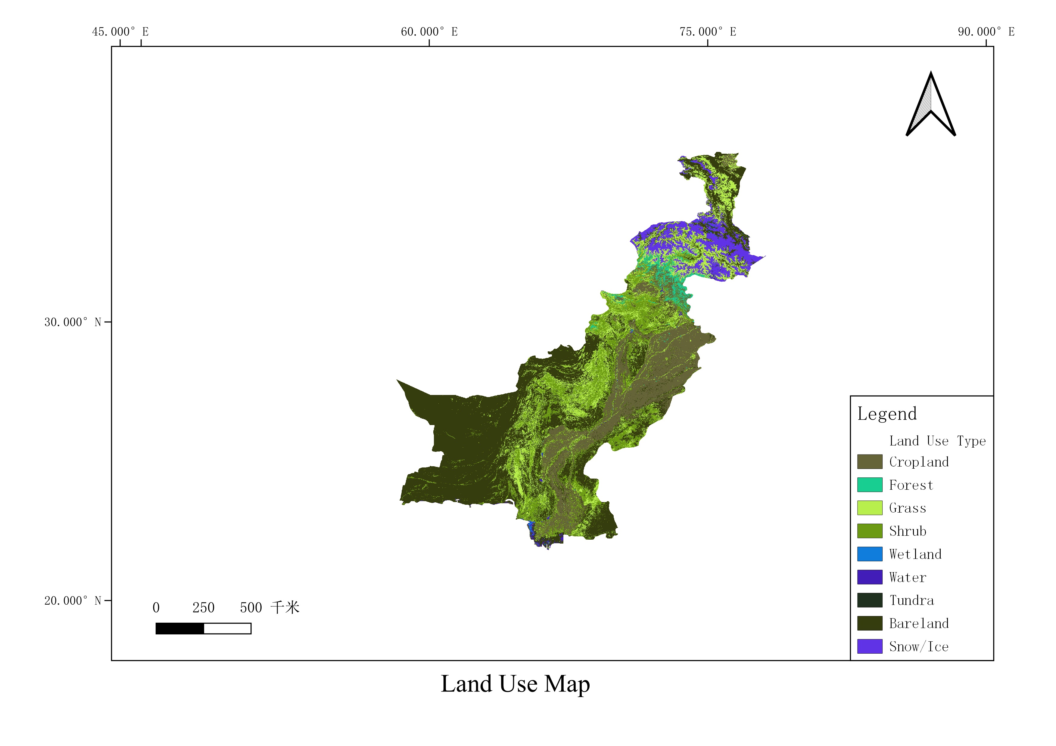
This dataset is the land use data of the China-Pakistan Economic Corridor region from 2000 to 2019. The land use data covering the China-Pakistan Economic Corridor region were obtained by downloading from some land use data platforms or websites, and the downloaded data were stitched and cropped to obtain the land use dataset covering the China-Pakistan Economic Corridor region; the data format is TIFF, the spatial resolution is 30-1000 m, and the time span is from 2000 to 2019.
Parent identifier
Earth Sciences
Language
zh CN
Format
geotiff
Publisher
Yang Fei
Organization
Institute of Geographic Sciences and Natural Resources Research,CAS
Classification
Natural Sciences
Access constraints
Fully shared
Date creation
2022-09-01
Date publication
2021-08-30
Crs
WGS84
Distanceuom
km
Information evaluation
Relevant information
- Annual consistency dataset for Pakistan's 500 meters NPP/VIIRS night light data
- Monthly consistency data of 500 meters NPPVIIRS luminous data throughout Pakistan
- China Pakistan Economic Corridor land cover dataset
- Pakistan wind energy resource dataset (2020)
- Pakistan’s water system dataset (2022)
- Basic remote sensing image map about 1 km of the China Pakistan Economic Corridor (2020)
- China Pakistan Economic Corridor Traffic Distribution Dataset (2022)
- Climatic zoning data set for Pakistan