Through comprehensive and multi-disciplinary cooperation, the China-Pakistan Economic Corridor will help to further strengthen and strengthen China-Pakistan all-weather strategic partnership. It is both a model project and a flagship project of China's “One Belt, One Road” initiative, and also provides development for Pakistan. Important opportunity. At present, the construction of the China-Pakistan Economic Corridor has achieved stage results, but at the same time it still faces many risks and challenges. Only by comprehensively understanding, fully assessing, and actively responding to risks can we achieve substantive results in corridor construction.
In May 2013, during his visit to Pakistan, Premier Li officially proposed the China-Pakistan Economic Corridor Vision Plan to assist Pakistan in infrastructure expansion and upgrading, aiming to promote and deepen the cooperation between the two countries in the fields of energy, security and economy. Effective docking of development strategies In 2015, China-Pakistan relations were upgraded from strategic partnerships to all-weather strategic partnerships. Among them, with the China-Pakistan Economic Corridor as the guide, focusing on Gwadar Port, energy, transportation infrastructure and industrial cooperation, the “1+4” economic cooperation layout will be formed. This is the key content of China-Pakistan cooperation and pragmatic cooperation to build a community of destiny.
Through the construction of this project, a talent team with a reasonable knowledge structure and age structure has been formed. At present, the total size of the team has reached 57 people, including 28 fixed personnel and 29 mobile personnel; Among the fixed personnel, 16 have senior professional titles; Among the floating personnel, there are 6 postdoctoral students, 10 doctoral students, and 10 master's students.
Contact: Data Service Group
Email: hedata@igsnrr.ac.cn
Address: 11A, Datun Road, Chaoyang District, Beijing, 100101, China
Institute of Geographic Sciences and Natural Resources Research, CAS

Digital China Pakistan Economic Corridor website(Quasar), used to display China-Pakistan map data and map metadata information. Web technology is based on the quasar framework.
Quasar (pronounced /ˈkweɪ.zɑɹ/) is an MIT licensed open-source Vue.js based framework, which allows you as a web developer to quickly create responsive++ websites/apps in many flavours.
Quasar’s motto is: write code once and simultaneously deploy it as a website, a Mobile App and/or an Electron App. Yes, one codebase for all of them, helping you develop an app in record time by using a state-of-the-art CLI and backed by best-practice, blazing fast Quasar web components.
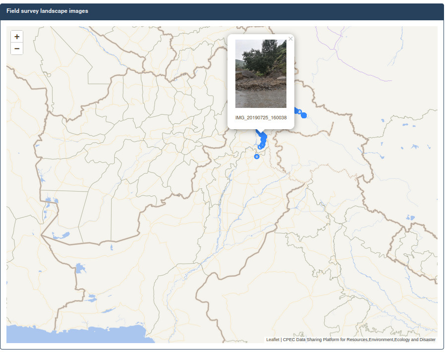
This application displays images of some field work of the National Science and Technology Basic Resource Survey Special Project "Basic Data Survey of Natural Disasters in the China-Pakistan Economic Corridor ".
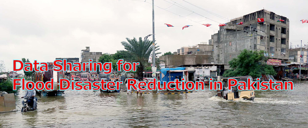
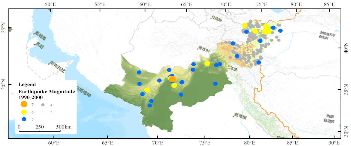
This project will systematically collect existing data and achievements, and conduct a comprehensive and systematic investigation of hydrological and meteorological disasters, ice and snow freeze-thaw disasters, geological disasters, earthquake disasters, and marine disasters in the China-Pakistan Economic Corridor through various technical means such as remote sensing interpretation analysis, field survey, drone aerial photography, and numerical simulation. Furthermore, we will integrate disaster background and disaster data, build a comprehensive database of natural disasters, develop a natural disaster information sharing service platform for the China-Pakistan Economic Corridor based on big data, cloud platform and Internet+, provide basic data and scientific technological support for major construction risk prevention of the China-Pakistan Economic Corridor, people's livelihood security and sustainable development, create a technological innovation service window and platform for the "the Belt and Road".
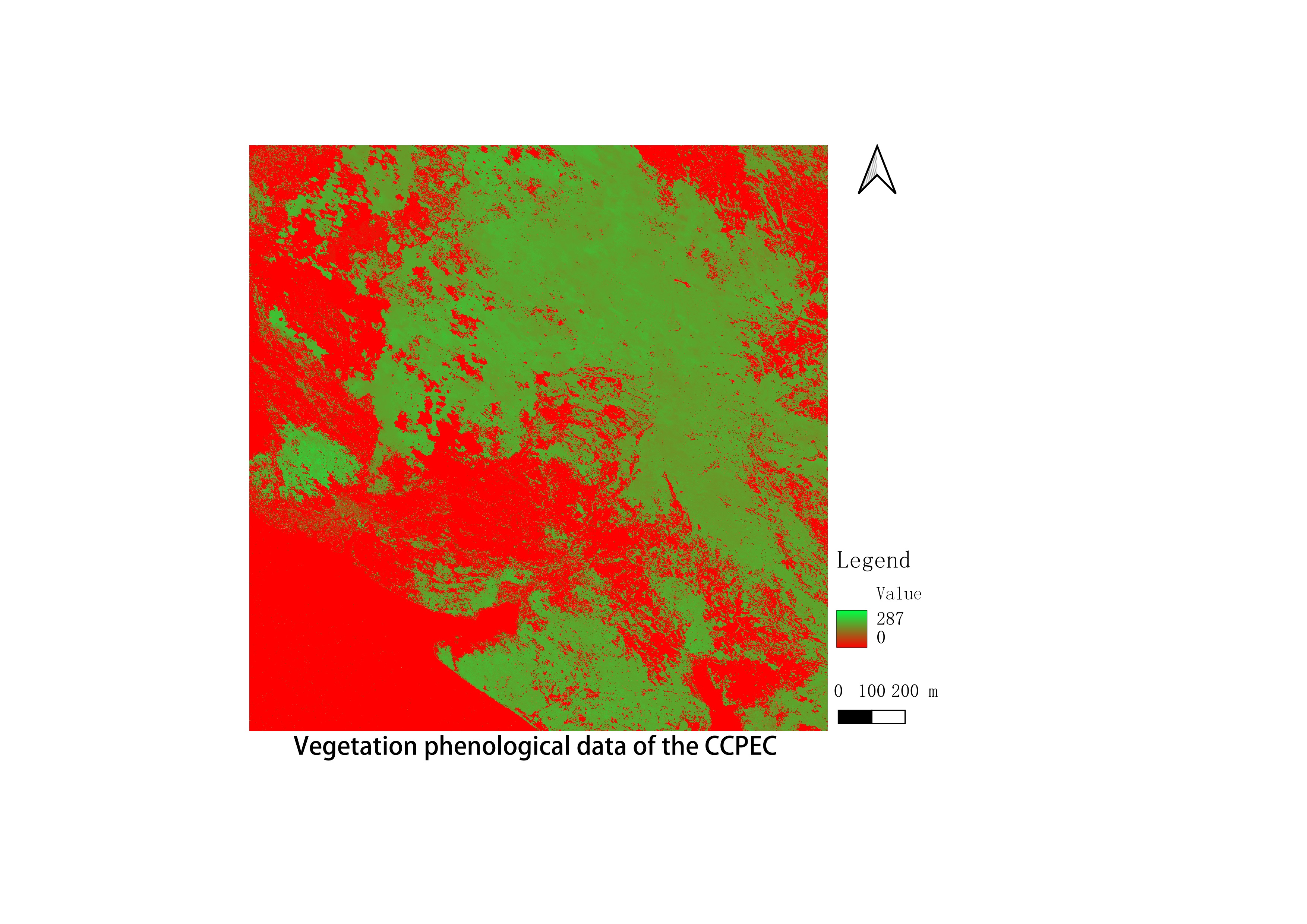
China-Pakistan Economic Corridor vegetation phenology dataset
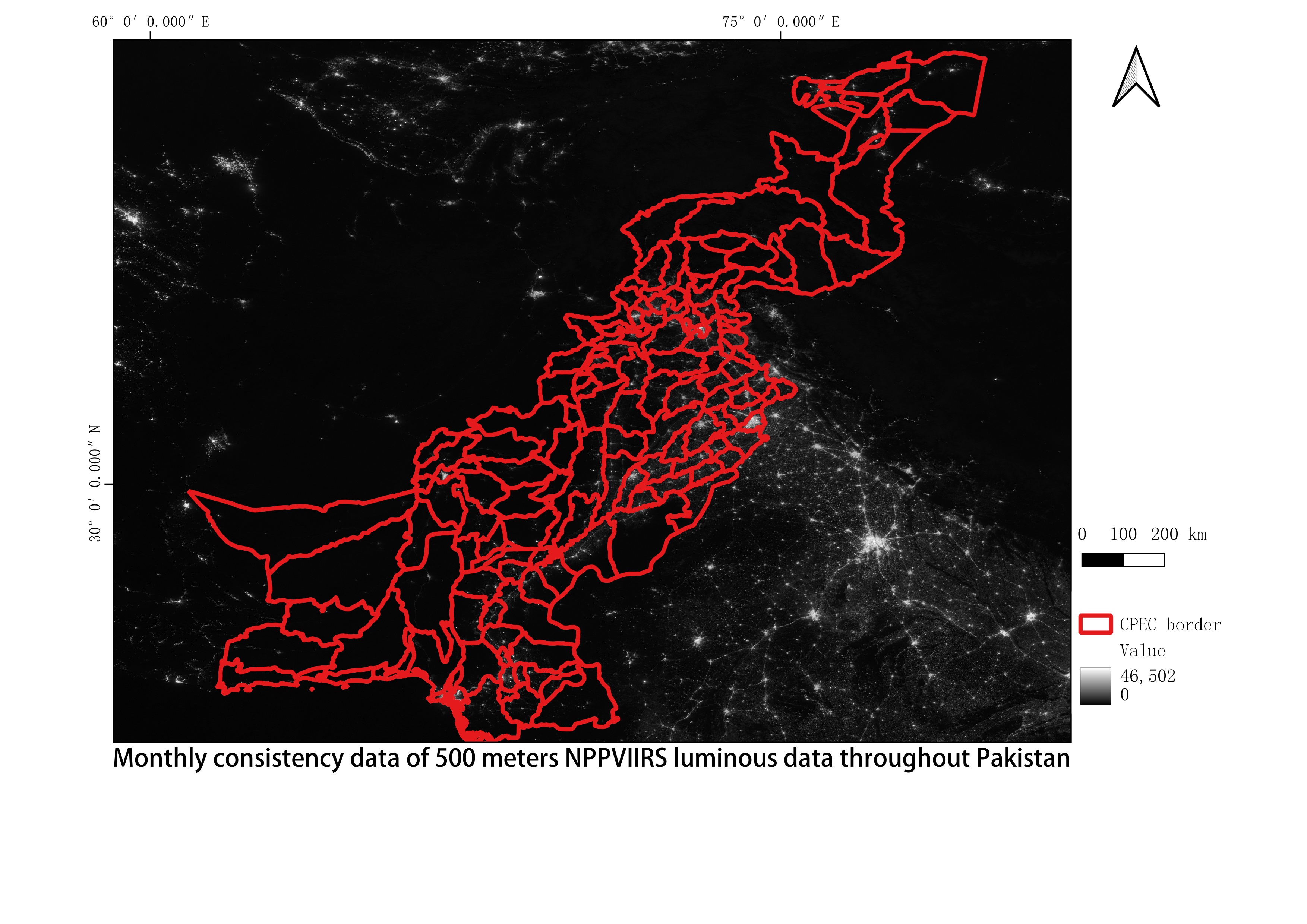
Monthly consistency data of 500 meters NPPVIIRS luminous data throughout Pakistan
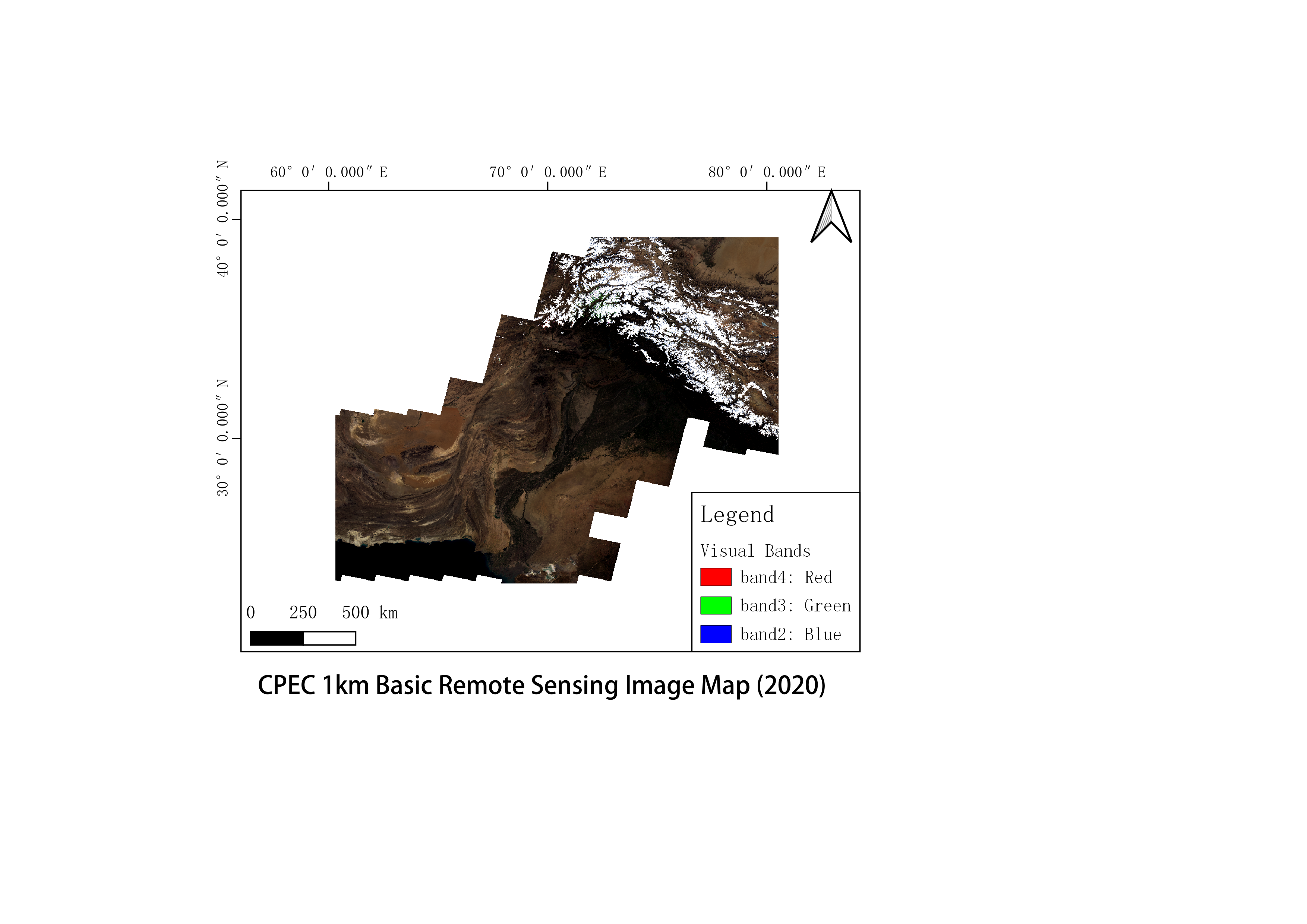
Basic remote sensing image map about 1 km of the China Pakistan Economic Corridor (2020)

Islamabad 10m sentinel cloudless quarterly dataset from 2017 to 2020
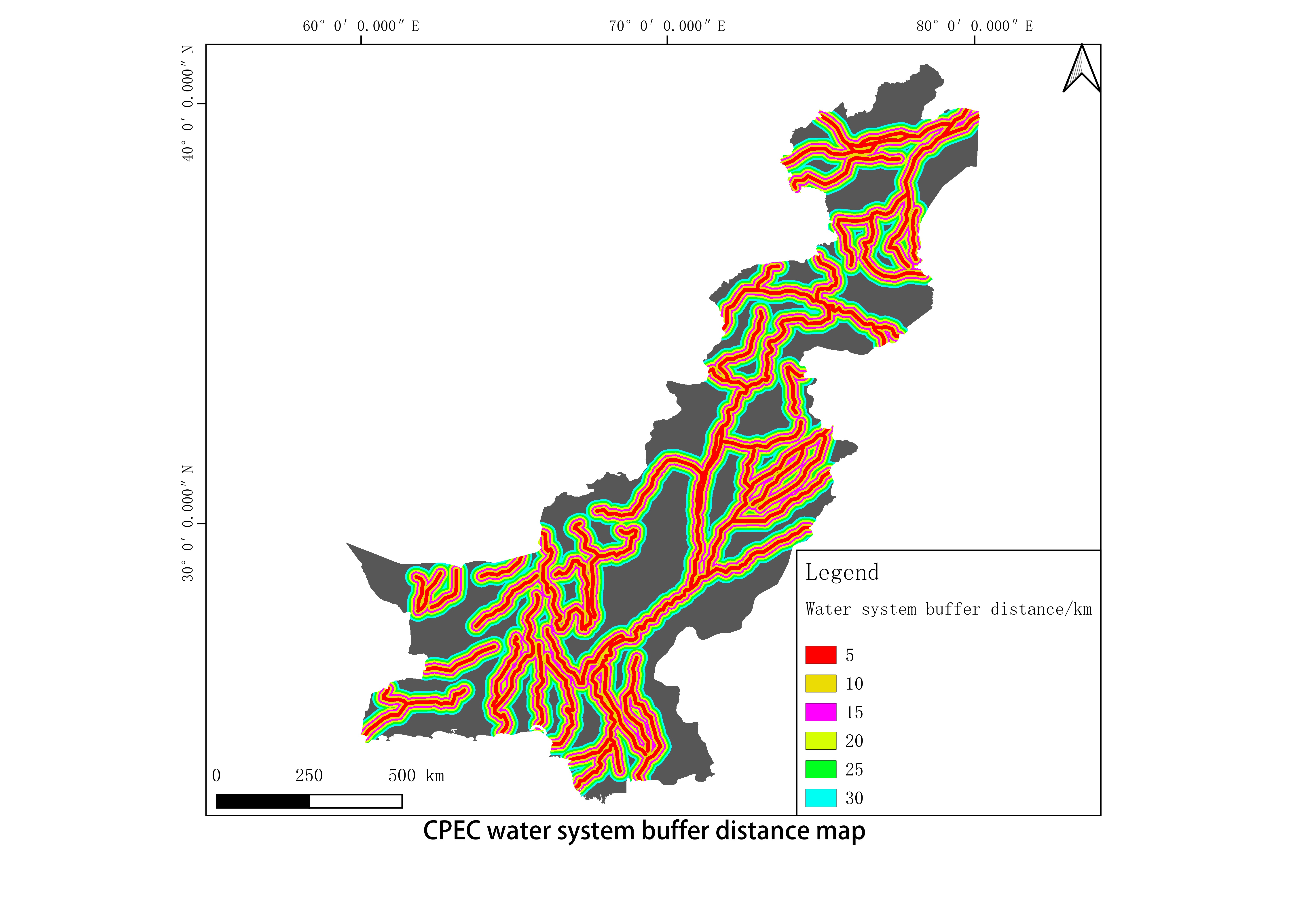
China-Pakistan Economic Corridor water system buffer distance data

Classification of soil types in the China Pakistan Economic Corridor