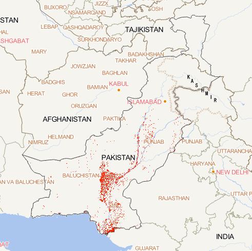
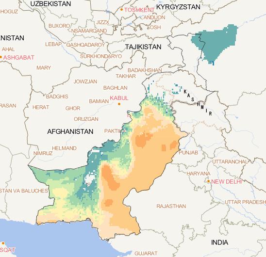
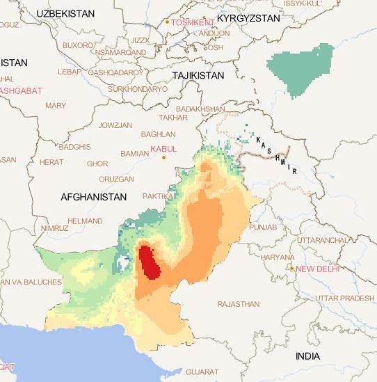
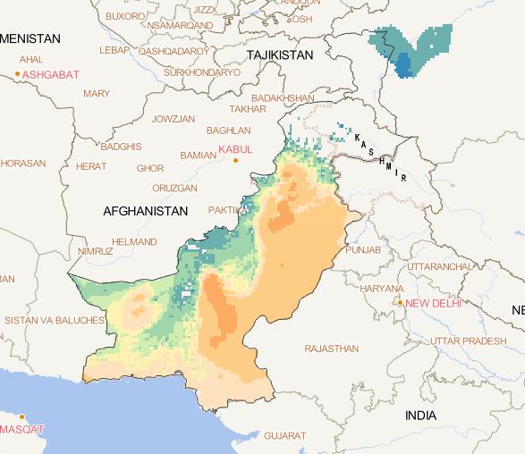
This dataset is the spatial distribution map of floods in
Pakistan in 2022.Google Earth engine is used to process
sentinel1 data and threshold method is used to extract water
body. The data format is tiff, and the spatialresolution is 30m....
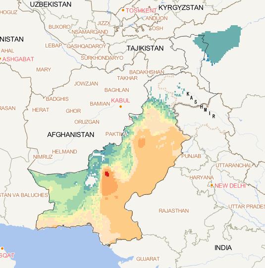
The NOAA meteorological station data covering the
China-Pakistan Economic Corridor was downloaded
and processed to calculate the data of the
high-temperature heat wave in the China-Pakistan
Economic Corridor, so as to obtain the high-temperature
heat wave data set covering t...
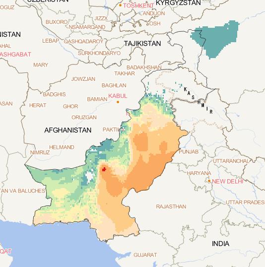
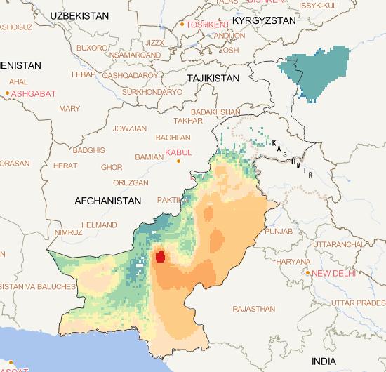
The NOAA meteorological station data covering the
China-Pakistan Economic Corridor was downloaded
and processed to calculate the data of the
high-temperature heat wave in the China-Pakistan
Economic Corridor, so as to obtain the high-temperature
heat wave data set covering th...
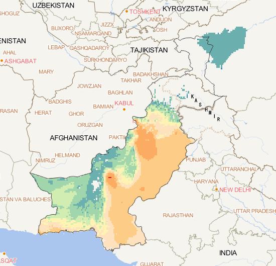
The NOAA meteorological station data covering the
China-Pakistan Economic Corridor was downloaded
and processed to calculate the data of the high-temperature
heat wave in the China-Pakistan Economic Corridor,
so as to obtain the high-temperature heat wave data
set covering th...
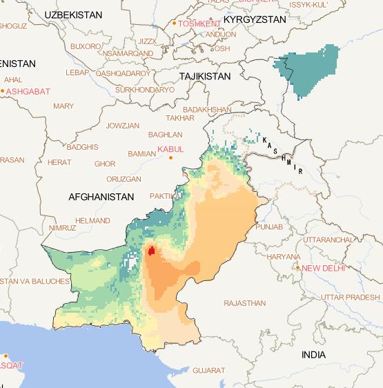
The NOAA meteorological station data covering the
China-Pakistan Economic Corridor was downloaded and
processed to calculate the data of the high-temperature
heat wave in the China-Pakistan Economic Corridor,
so as to obtain the high-temperature heat wave data
set covering th...
The NOAA meteorological station data covering the
China-Pakistan Economic Corridor was downloaded
and processed to calculate the data of the
high-temperature heat wave in the China-Pakistan
Economic Corridor, so as to obtain the high-temperature
heat wave data set covering th...
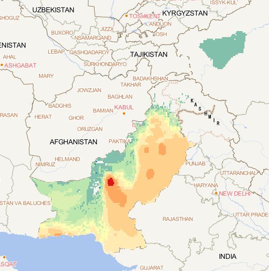
The NOAA meteorological station data covering the
China-Pakistan Economic Corridor was downloaded
and processed to calculate the data of the
high-temperature heat wave in the China-Pakistan
Economic Corridor, so as to obtain the high-temperature
heat wave data set covering t...
The NOAA meteorological station data covering the
China-Pakistan Economic Corridor was downloaded and
processed to calculate the data of the high-temperature
heat wave in the China-Pakistan Economic Corridor,
so as to obtain the high-temperature heat wave data
set covering th...
The NOAA meteorological station data covering the
China-Pakistan Economic Corridor was downloaded
and processed to calculate the data of the
high-temperature heat wave in the China-Pakistan
Economic Corridor, so as to obtain the high-temperature
heat wave data set covering the...
The NOAA meteorological station data covering the
China-Pakistan Economic Corridor was downloaded and
processed to calculate the data of the high-temperature
heat wave in the China-Pakistan Economic Corridor,
so as to obtain the high-temperature heat wave data
set covering t...