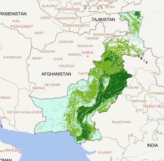
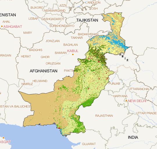
The spatial distribution of land use data in the
China Pakistan Economic Corridor region in 2001
was obtained from Finer Resolution Observation
and Monitoring - Global Land Cover (tsinghua. edu. cn),
with a spatial resolution of 250m , and the spatial
coordinate system of WGS...
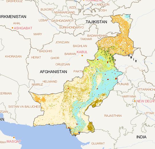
The spatial distribution of land use
in the China Pakistan Economic Corridor
region in 2005, sourced from the European
Space Agency (ESA GlobCover)
http://due.esrin.esa.int/page_globcover.php
The spatial resolution is 300m and the spatial coordinate system is WGS 84....
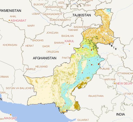
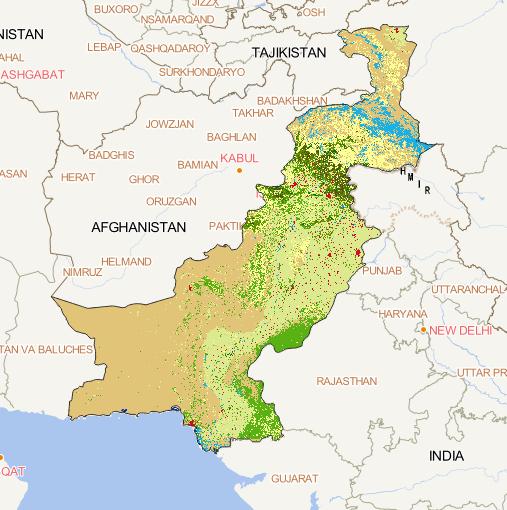
The spatial distribution of land use in
the China Pakistan Economic Corridor region
in 2005, sourced from the European Space Agency
(ESA GlobCover)
http://due.esrin.esa.int/page_globcover.php
The spatial resolution is 300m and the spatial
coordinate system is WGS 84....
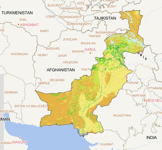
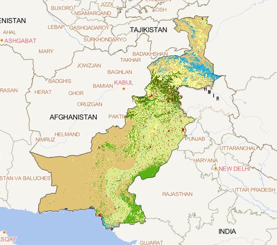
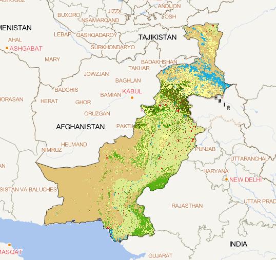
The spatial distribution of land
use in the China Pakistan Economic
Corridor in 2010, sourced from the
National Geographic Information Resource Catalog Service System
http://www.webmap.cn/mapDataAction.do?method=globalLandCover
The spatial resolution is 30m, and the spatial c...
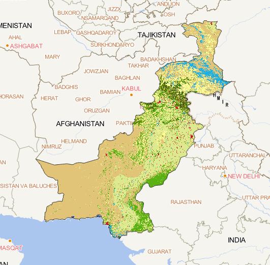
The spatial distribution of land use
in the China Pakistan Economic Corridor
region in 2015, sourced from Copernicus
Global Land Services
https://land.copernicus.eu/global/content/annual-100m-global-land-cover-maps-available
The spatial resolution is 100m, and the spatial co...
The spatial distribution of land use
in the China Pakistan Economic Corridor
region in 2016, sourced from Copernicus Global
Land Services
https://land.copernicus.eu/global/content/annual-100m-global-land-cover-maps-available
The spatial resolution is 100m, and the spatial co...
The spatial distribution of land use in
the China Pakistan Economic Corridor
region in 2017, sourced from Copernicus Global Land Services
https://land.copernicus.eu/global/content/annual-100m-global-land-cover-maps-available
The spatial resolution is 100m, and the spatial coo...
The spatial distribution of land use in the
China Pakistan Economic Corridor region in 2018,
sourced from Copernicus Global Land Services
https://land.copernicus.eu/global/content/annual-100m-global-land-cover-maps-available
The spatial resolution is 100m, and the spatial coor...
The spatial distribution of land use in the China Pakistan
Economic Corridor region in 2019, sourced from Copernicus
Global Land Services
https://land.copernicus.eu/global/content/annual-100m-global-land-cover-maps-available
The spatial resolution is 100m, and the spatial coo...
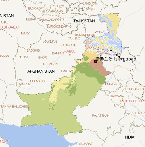
Using Google Earth cloud platform, climate data is selected as the basic data. On the basis of this data, the Pakistan climate zoning data set with a resolution of 10m is obtained by cutting....