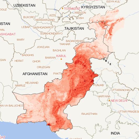
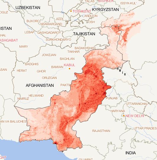
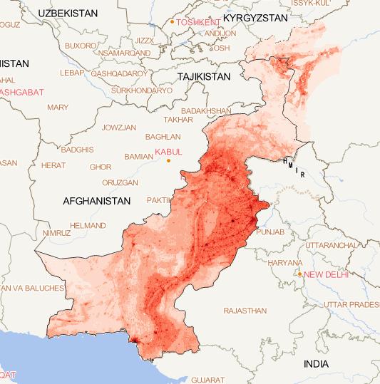
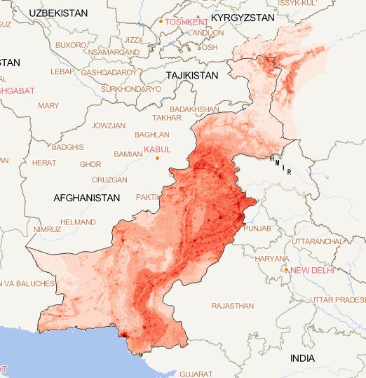
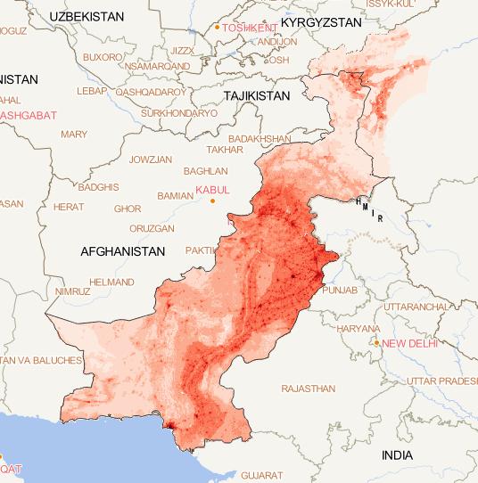
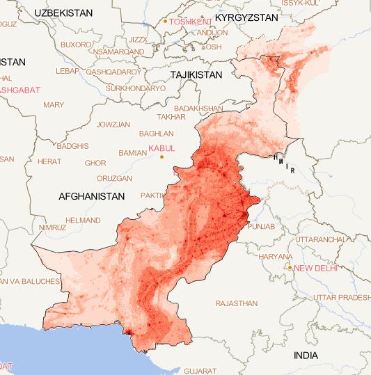
Based on wechat image data, the annual population
data set of the China-Pakistan region from 2000
to 2015 is calculated. This issue is the population
data of the China-Pakistan Economic Corridor in 2015,
with a spatial resolution of 100m and a spatial
coordinate system of WGS 8...
2023-08-15